

Harness the Power of Multispectral Satellite Imagery For Better Farm Management
The agriculture industry is facing rising supply costs, labor shortages, admirable sustainability goals, and a greater need for crop transparency. Luckily, technological advancements are helping to solve all these serious challenges.

Farmers are using advanced technology to increase yields by creating more efficient farms. Major technologies like automation and robotics, sensors, animal tracking, and artificial intelligence have all come onto the scene to vastly improve farming practices.
However, one technology stands out as an anchor for an amazing shift in how farmers and agronomists run their farms. That technology is multispectral satellite imagery.
Multispectral satellite imagery – what’s new and what’s next

Multispectral satellite imaging is the capturing, processing, and analyzing of satellite images in different wavelengths of light. It's been around for decades and was originally used by the military and aerospace industries.
The agricultural industry was also an early adopter, as multispectral imaging provided agronomy maps of information across the farm, but its uses were relatively limited. Today, however, multispectral satellite images allow farmers to identify problems with their crops and soil that are not visible to the naked eye.
What changed?

Massive improvements in the quality and availability of satellite data. Satellite photos of specific areas on Earth used to be taken every few weeks. Helpful but not super useful for catching issues promptly. And the image quality was low, providing just primary data.
The number of satellites has dramatically increased. In addition, in 2010, an innovative company, Planet, began using mini satellites to take pictures of the Earth every 10 minutes. Today, Planet has a fleet of over 200 earth imaging satellites taking images of the Earth’s land mass daily.
Images taken minutes apart of the same farm area allow for detailed comparisons that give farmers a clear picture of crop changes. However, the real game changer comes from high-resolution imagery.
Working off low or even medium-resolution images meant the images could only provide basic information for farming operations. Today’s high-resolution images offer crisp and clear pictures, with a greater ability for capturing multispectral data.
High-resolution images give agronomists access to detailed information about a crop’s health, development, and yield potential. However, the actionable data insights from the images are what makes them an effective farming operations tool.
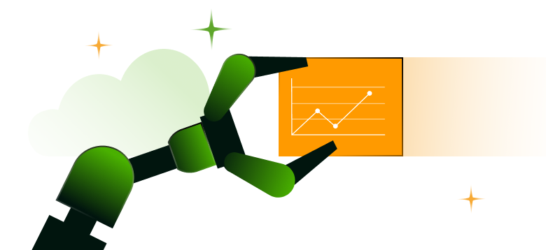
Results-triggering actions happen through analysis, dashboards, machine learning, data robotics, augmented reality, and data integrations. Multispectral imaging is typically 5-7 wavelength bands of measurement, and there are many potential use cases. You can tackle complex problems like weeds, diseases, pests, water levels, and crop deficiencies on an integrated and scalable level.
The next technology to consider is hyperspectral imaging. Instead of 5-7 wavelength bands, hyperspectral satellite images capture hundreds of narrow and contiguous wavelength bands. This technology allows farms to gather incredibly detailed analysis of a plant's chlorophyll content, water stress, and nutrient levels, among other things, which are critical parameters for the efficient and effective management of crops.
Artificial intelligence and machine learning can process the vast amounts of data generated by hyperspectral imaging to detect subtle changes in crops and predict future trends, providing valuable insights into crop management that were previously not possible.
The farming industry is working on using hyperspectral imaging to extend satellite imagery. Chances are, once farming operations have the infrastructure leveraging multispectral imagery, hyperspectral imagery will be easily incorporated.
Thanks to massive improvements in the quality and availability of satellite data, and with the advent of precision architecture, action monitoring and command solutions can help run the farm and protect against disaster and disease.
Creating the farming command and control center
Multispectral satellite images are the anchor for creating a farming command center. Leverage product integrations and advanced technologies to initiate proactive action.
It all starts with data. The multispectral satellite data we’re getting today is vast and needs to be analyzed independently and with data from other farming systems.
Before laying out the requirements to build a farming control center, here are some top use cases where multispectral imaging insights are most valuable.
 |
 |
 |
 |
 |
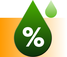
Moisture |
Insect invasion |
Nitrogen levels (about fertilizer) |
Encroachment |
Cheap grass growing |
The essential requirements to leveraging multispectral images and creating a state-of-the-art farming command center are actions and insights, like:

- Visualization and analytics
- Artificial intelligence and machine learning
- Action and automation
- Third-party integrations
- Augmented reality
Visualization and analytics
The first step is to use the data to create analytics, overlays, maps, and dashboards to provide a comprehensive overview of an entire field or focus on a particular area. Multispectral data cross analyzed with other data, like historical trends, weather, crop scouting, and drone data provides agronomists with a better understanding of crops and potential problems before they become an issue.
Multispectral imagery provides the data for intense analytics. What comes next is using that data for focused monitoring.
Artificial intelligence (AI) and machine learning (ML)

The primary goal of multispectral imaging is to detect subtle changes in crop or field health before it becomes visible so farmers can react immediately. To do this, you need advanced technologies to create deep insights and monitor farms proactively.
AI and ML provide the tools to create algorithms to monitor a specific area, crop, or problem. Then, additional algorithms can be created for “what-if” scenarios, like:
What if water levels lower over the next year? What if global warming weather patterns change crop production? Will we achieve higher yields if we use this land for a different crop? Can I identify field segments that require specialized treatments?
Action and automation
At this point, the farming control center is taking shape. Focused analytics and monitoring are in place to alert agronomists of potential problems. The action taken depends on the issue and the level of technology available.
Manual alerting an agronomist in the field to act is sometimes the only answer. However, workflow systems will automate sending alerts, suggest resolutions, and sometimes initiate the solution. Proactive action plans based on analytics and algorithms can be a powerful tool for avoiding disaster or creating better crops.
Third-party integrations
The agricultural technology ecosystem is fragmented, and third-party system integrations are key to automation. For example, suppose a farm area shows low fertilizer levels, and you're integrated with the ERP system. In that case, a workflow can signal the ERP to order the right fertilizer.
Another example would be to use ML to create an algorithm to detect weed growth. Once overgrowth is detected, a workflow signals a weeding robot to start pulling weeds.
Augmented reality (AR)

Farmers and agronomists can take field action to the next level by combining augmented reality. Walking the field with AR glasses can take all the multispectral and ML data analysis and point out problem areas virtually.
Imagine the time saved when you know where to walk and what to look for.
The SoftServe difference
Farms are complex ecosystems, and the advances in multispectral satellite imaging data are leading the way to better farming operations. In order to leverage the data and implement a farming control center, a lot of knowledge and skill is needed.
SoftServe has high-caliber data scientists, robotics engineers, integration systems specialists, and AR professionals who know AG. We’ve developed for our customers:
- Algorithms to achieve specific ends using multispectral and other field environment data
- Integrated farming systems, including robotics and IoT
- Monitoring, alerting, and action automated workflow systems